More than four thousand years ago, a settlement on the western coast of the Indian subcontinent was connected to a wider trading world.
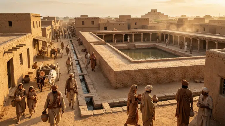
Lothal, in present-day Gujarat, is famous for an archaeological feature often described as a dockyard or tidal basin.
Whether every detail of that interpretation is correct, the site clearly demonstrates that Indus communities understood water, craft production and long-distance exchange.
A city connected to the sea
Lothal’s location near ancient channels and the Gulf of Khambhat gave it access to maritime and riverine networks.
Archaeologists have found evidence of craft production, beads, seals and other goods associated with trade.
The famous basin
A large brick-lined structure has traditionally been interpreted as a dockyard.
Researchers continue to discuss exactly how it functioned, especially given changes in the ancient landscape and uncertainty about water levels.
Even if the structure had multiple functions, its scale demonstrates careful planning around water.
Bead-making connected Lothal to distant markets
Craft production was a major part of the settlement’s economy. Carnelian beads and other objects associated with Indus craftsmanship have been found in distant regions.
Trade therefore connected local production to a much wider network.
Ports are more than places for ships
A functioning trading center requires storage, workshops, roads, administrative systems and people who can organize exchange.
Lothal’s archaeology reveals a settlement where economic activity was integrated with urban infrastructure.
Why the environment changed
The coastline around Lothal is not the same as it was thousands of years ago. Sedimentation, river changes and sea-level processes altered the landscape.
This makes reconstructing the ancient harbor environment challenging.
The deeper lesson
Lothal matters because it shows that the Indus Civilization was not isolated.
Its communities participated in networks connecting South Asia with regions farther west.
The “port city” story is therefore not just about ships. It is about how technology, craft and geography combine to connect civilizations.
What made Lothal a useful trading settlement?
Trade requires more than a water connection. Merchants need workshops, storage, roads, administrative systems and access to producers and consumers.
Lothal’s archaeology reveals evidence of bead manufacture, seals, pottery and other craft activities, suggesting that production and exchange were integrated into the settlement.
Beads reveal long-distance connections
Carnelian and other semi-precious stone beads associated with Indus craftsmanship have been found far beyond the immediate region. Such finds demonstrate that skilled local production could enter long-distance exchange networks.
An imported object therefore represents not just movement but a chain of relationships linking producers, traders and consumers.
Was the famous basin definitely a dockyard?
The large brick-lined basin has traditionally been interpreted as a dockyard or tidal facility. Because the ancient landscape has changed significantly, researchers must reconstruct former channels and water levels to understand exactly how the structure functioned.
The safest conclusion is that Lothal’s builders invested heavily in water management and organized infrastructure, while the precise function of every feature remains an archaeological question.
Why coastlines make archaeology difficult
Rivers migrate, sediments accumulate and sea levels change. A harbor that once connected directly to navigable water can become stranded inland over thousands of years.
This means modern geography can be a poor guide to ancient maritime connections.
Lothal belongs to a wider Indus network
The settlement was part of the broader Indus Civilization, whose communities shared urban practices, craft traditions and systems of exchange across a large region.
Lothal’s maritime connections show that this network extended toward the Arabian Sea and beyond.
The port was really a system
Whether every feature functioned exactly as early interpretations proposed, Lothal demonstrates that water, craft production and trade were interconnected.
The site’s significance lies less in one famous brick structure than in the wider evidence for an organized economic landscape.
Lothal and the Maritime World of the Harappans
Lothal is one of the most important archaeological sites associated with the Indus or Harappan Civilization in present-day Gujarat. Its location, craft industries and water-related structures have made it central to discussions of long-distance trade and maritime activity. Yet the most interesting story is not simply that Lothal was a port. It is how archaeologists reconstruct a connected urban economy from buildings, artifacts, waterways and regional geography.
A planned settlement
Lothal contains evidence of organized streets, residential areas, drainage and industrial activity. The settlement developed through different phases, reflecting changes over time rather than one frozen moment. Its architecture shows that urban life in the Harappan world depended on planning, standardized construction and specialized activities.
The famous dockyard
One of Lothal’s best-known features is a large brick-lined basin interpreted by many archaeologists as a dockyard. The proposed interpretation is connected to the site’s location near ancient channels and the wider coastal landscape. However, the exact function of archaeological structures can remain debated, and interpretations depend on reconstructing ancient water levels, sedimentation and shoreline change.
Why the coastline matters
Modern geography cannot simply be projected backward onto a Bronze Age settlement. Rivers shift, channels silt up and coastlines change. Lothal’s relationship with the sea must therefore be reconstructed from geology and archaeological context as well as its present location. This is one reason the site’s waterways are so important to understanding its economic role.
A center of craft production
Archaeological evidence indicates specialized production at Lothal, including bead-making and other crafts. Standardized materials and manufacturing debris reveal that production was organized beyond the level of isolated household activity. Finished goods could move into wider exchange networks, connecting local craftsmanship with regional and long-distance trade.
Connections beyond Gujarat
Harappan settlements participated in networks extending across the northwestern Indian subcontinent and beyond. Artifacts and raw materials provide clues about exchange relationships with regions that were culturally and geographically distant. Lothal’s significance therefore lies partly in its position within a broader system rather than in being an isolated “Indian port.”
Water management
Water was central to settlement survival and economic activity. Wells, drains and other water-related structures show attention to controlling and using water within the urban environment. Such infrastructure also reflects the need to adapt to seasonal conditions and changing local hydrology.
What happened to Lothal?
The transformation of Lothal occurred within the wider changes affecting Harappan urban centers. Researchers have considered environmental shifts, changes in river systems, economic reorganization and the broader transformation of long-distance exchange. There is no need to assume a single catastrophic event. Urban systems can change through multiple interacting pressures over generations.
Why Lothal matters
Lothal provides a window into a civilization that connected urban planning, craft specialization, water management and long-distance exchange. Its importance does not depend on proving that every reconstruction is correct. The site is valuable precisely because archaeological evidence allows competing interpretations to be tested against material remains and changing environmental evidence.
How archaeologists reconstruct a vanished coastline
One of the most important cautions in the Lothal story is that the landscape visible today is not the landscape its inhabitants knew. Archaeologists therefore combine several kinds of evidence: the position of the settlement, ancient channels, sediment deposits, the elevation of structures, water-management features and the distribution of artifacts. None of these clues is sufficient by itself. Together, however, they can help reconstruct how people may have moved goods and water through a landscape that has been altered for thousands of years.
This also explains why the word “dockyard” should be used carefully. A modern dock is easy to recognize because its purpose is documented and its surrounding coastline is known. At Lothal, researchers have to infer function from physical remains and environmental reconstruction. The strongest historical conclusion is therefore broader than the label: the settlement was deliberately organized around water and exchange, while the exact operational history of its large basin remains a subject for archaeological interpretation.
What a trading center actually needed
Long-distance trade is often imagined as a sequence of ships arriving and departing, but an ancient trading economy required an entire chain of activities. Raw materials had to reach workshops. Craftspeople had to transform them into standardized or desirable goods. Finished products needed storage and transport. Traders needed places to exchange goods, while administrators and communities needed systems for maintaining infrastructure.
Lothal is especially interesting because evidence for several parts of that chain occurs within the same settlement. Bead production, pottery, seals, buildings and water infrastructure create a picture of an economy in which manufacturing and exchange were closely connected. This does not prove the identity or social status of every person involved in trade, but it makes the settlement more understandable as an organized economic community rather than simply a residential town beside water.
Why carnelian beads matter
Carnelian beads are more than attractive archaeological objects. Their manufacture involved selecting stone, cutting it, shaping it, drilling it and often producing a carefully finished surface. When comparable objects appear far from their production centers, they provide clues about the movement of both materials and finished goods.
Such evidence also changes how we think about “trade.” An artifact found in a distant settlement does not mean that a single merchant carried it directly from Lothal. It may have passed through several communities and exchange relationships. Archaeology can identify patterns of connection more readily than it can reconstruct every transaction. That distinction matters when turning material evidence into a story about the ancient economy.
Lothal and the larger Harappan world
Lothal should not be understood in isolation. The Indus Civilization consisted of settlements spread across a very large geographic area, with recurring patterns in construction, weights, craft traditions, seals and other material culture. The existence of such similarities suggests networks of communication and shared practices, even though individual settlements had different environments and economic roles.
Lothal adds a particularly important coastal dimension to that picture. Its location helps researchers ask how Harappan communities interacted with the Arabian Sea and with regions beyond South Asia. Written records from the Harappan civilization remain limited, so archaeologists cannot simply read an ancient shipping ledger. Instead, they reconstruct connections from objects, production techniques, raw materials and settlement geography.
Could the basin have had more than one function?
Ancient infrastructure does not always fit a single modern category. A large water-related structure could potentially have supported several activities over its lifetime, particularly if water levels and channels changed. Its construction may also have been modified as the settlement evolved.
That possibility does not make the archaeological evidence meaningless. It changes the question. Rather than asking only, “Was this definitely a dockyard?”, researchers can ask what the structure was designed to accomplish, how it interacted with surrounding buildings and channels, and what forms of use are physically compatible with its dimensions and setting. This approach is more cautious, but it can also produce a richer picture of how the settlement functioned.
The environment may have shaped the city as much as trade did
Lothal’s story is also a reminder that ancient urban centers were embedded in changing ecological systems. Rivers can migrate, channels can become shallower, sediment can accumulate and coastal environments can reorganize. A settlement that was strategically positioned under one set of environmental conditions could become less useful as those conditions changed.
That does not mean environmental change alone “destroyed” Lothal. The transformation of Harappan urbanism appears to have involved multiple factors, and archaeologists continue to debate how regional environmental and economic changes interacted. The evidence supports a history of adaptation and transformation more readily than a simple disaster narrative.
What Lothal can—and cannot—tell us
Lothal provides unusually valuable evidence for the relationship between craft production, water management, settlement planning and exchange. It cannot, by itself, reconstruct the entire maritime economy of the Harappan world, nor can one archaeological structure answer every question about how trade was organized.
That distinction is part of what makes the site fascinating. The most durable lesson is not that archaeologists have found a perfectly preserved ancient port. It is that a Bronze Age community built an urban environment capable of supporting specialized production and participation in wider networks, while adapting to a landscape whose waterways were never static.
How archaeologists distinguish a port from a settlement beside water
The presence of water beside an ancient settlement is not enough to prove maritime trade. Archaeologists look for a combination of clues: access to navigable channels, facilities for handling goods, craft production, storage, transportation routes and objects whose distribution indicates exchange. Lothal is important because several of these lines of evidence occur together.
This also explains why archaeological interpretation can change without making earlier discoveries worthless. The evidence is fixed; the explanation is tested and refined as new geological and comparative evidence becomes available.
Trade leaves a complicated archaeological footprint
Long-distance exchange rarely leaves a simple record saying where an object began and who carried it. Researchers instead follow patterns in raw materials, manufacturing techniques, styles, weights and distributions. If an unusual material appears in several distant settlements, its geological origin and manufacturing traces can help reconstruct possible routes of movement.
Lothal therefore belongs to a much larger story about connectivity. Its importance is not that every object found there proves overseas trade, but that the settlement provides multiple clues that can be compared with evidence from other Harappan communities and regions farther west.
The human story behind the infrastructure
It is easy to describe Lothal through bricks, drains, beads and waterways and forget the people who made the system work. A functioning craft economy required skilled specialists, suppliers of raw materials, transport workers, traders, builders and people maintaining water and storage infrastructure. Archaeology rarely gives us their names, but the organization of the settlement preserves traces of their collective activity.
Curiosity Publication by Aadvik Agastya
Sources & further reading
Have a question about this topic?
Join fellow Qurons on the Quron Forum to ask questions, challenge ideas, share discoveries and explore further.
Discuss on Quron Forum